This Saturday a group of us decided to venture out to the nearby Ngong hills for a little exercise and fresh air. The Ngong hills are located just outside Nairobi high on the plateau overlooking the Great Rift Valley in nearby Ngong. The hills are only a 40 minute drive from the compound along Ngong road, which is one of the main roads heading into Nairobi.
On Saturday morning we all woke up around seven o'clock, had breakfast, packed lunches, and headed to the bus around eight. Along with Adan, one of the friendly
askari (guards) who works on the compound, we made the 40 minute trip to the foot of the Ngong Hills at Kona Baridi, a small village located at a very sharp and windy bend in the road. There we met our Maasai guides for the hike, a group of three young local men who accompanied us on the hike. Although guides are not required, security can sometimes be an issue, and the presence of the armed guides was a precautionary measure we took as a group.
We started hiking shortly after nine o'clock and headed up the dirt road from Kona Baridi towards the first of the seven hills on the hike. From there, the trail took us up and over several of the high grassy peaks and we continued to climb higher and higher. Some two hours in we reached the halfway point at the top of the fifth and tallest hill, where we stopped to catch our breath and take in the gorgeous views of the Great Rift Valley. During this water break we were also fortunate enough to meet Mr. Johnston Waithiru, a local business man and self-proclaimed sportsman who offered to lead us in an elaborate stretch and fitness routine before we started to head onwards to the remaining peaks. His enthusiasm was contagious and we left the halfway point following our break with a new spring in our step and a new friend.
 |
| A little selfie love at the beginning of the hike...notice the cloud behind me |
 |
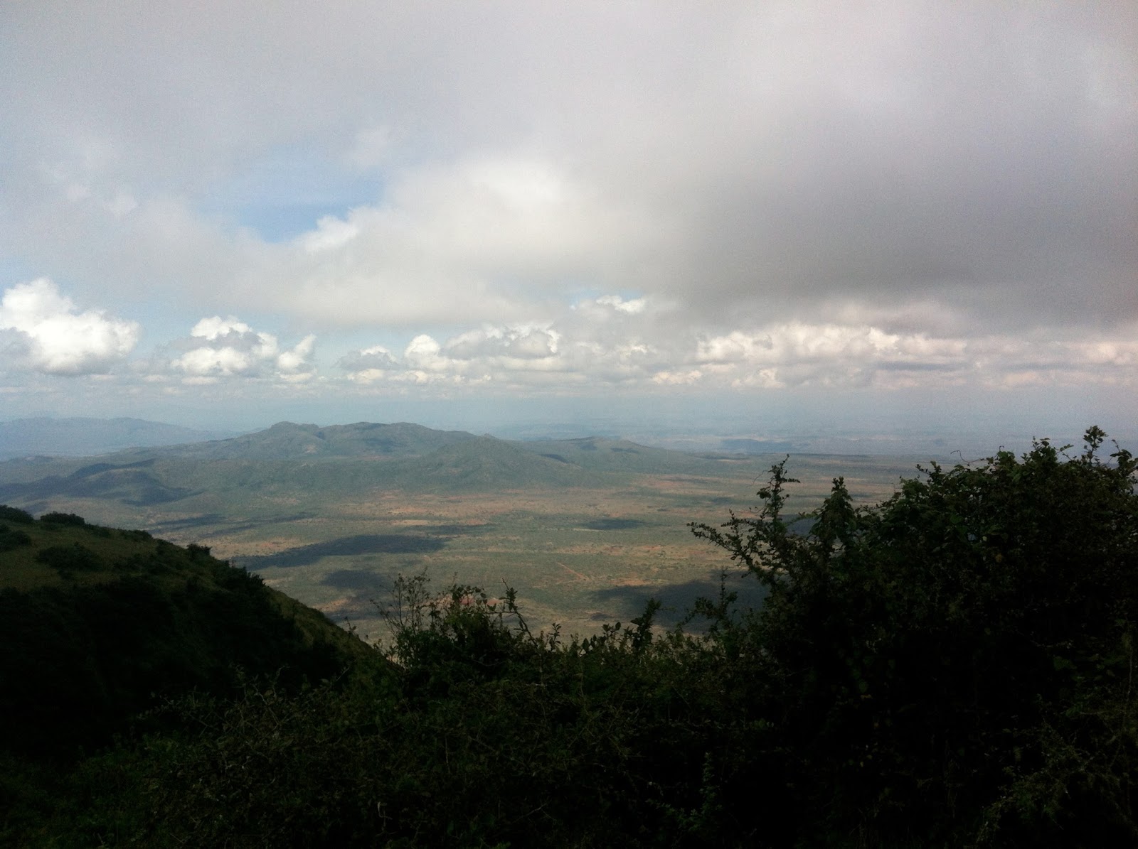
| The clouds finally cleared and allowed me to take this shot on the way up peak three. |
 |
| Group photo from the top of the fifth peak around 7800 feet. |
 |
| Ally stands amidst the clouds as the sun peeks through on the top of peak five. |
 |
| Looking at the sixth peak as we head down the backside of the fifth. |
 |
| A local scout troop does some drill practice on top of peak six. |
 |
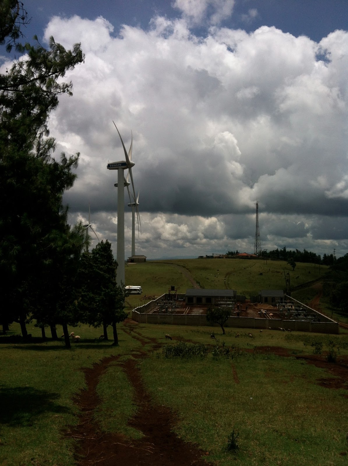
| A view from the end of the hike of the windfarm at the bottom of peak seven. |
From the halfway point on, we continued to hike down into the valleys between the remaining peaks and up the following hills, sucking wind most of the time as the altitude (fluctuating between 6000-8000 ft). On top of the sixth and seventh peaks we met groups of school children and young scouts (respectively), both whom were out for some physical fitness training on the sunny Saturday morning. We descended the final hill around noon, and stopped at the bottom of it to take lunch and relax in the shadow of several giant wind turbines clustered around the base of the hill.
A short ten-minute walk down a dirt road took us past the Kenya Wildlife Service ranger station at the northern entrance to the park and led us right to our bus, which returned us to the compound in Karen for a relaxing afternoon and some much needed naps. At the end of the day, the burner of a hike left most of us pretty exhausted, although not too much to keep from enjoying the beautiful weather for the rest of the weekend.


No comments:
Post a Comment